Natural History
 |
||
|
||
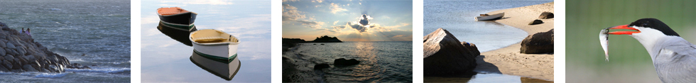
The natural history of Quissett Harbor and the Knob have been characterized using a combination of reports, aerial photographs, and maps on the geology sediments, coastal processes, and water quality of the area. Additionally, field investigations were conducted to determine the flora and fauna, sediment transport patterns, and the location and extent of wetland resources. The purpose of this section is to summarize existing information on the natural history of Quissett Harbor and the Knob.
Geology
In summary, the sediments of the Quissett Harbor and the Knob were deposited duringt he Pleistocene glacial period, forming part of the Buzzards Bay moraine. This moraine extends from the Elizabeth Islands, along the western shore of Cape Cod, to the Cape Cod canal. A rapid rise in sea level, approximately 7,000 years ago, caused inundation and flooding of Buzzards Bay. As the water continued to rise, the interaction of winds, waves, tides, and sediment transport resulted in formation of the current shorelines of Buzzards Bay.
Wetland Resources
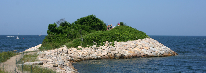
Wetland resources have been identified through a series of site visits, during which time the boundaries and approximate locations of the resources areas were identified. The area contains a number of valuable coastal and wetland resource areas. The coastal beaches, coastal dunes and coastal banks play a crucial role in buffering inland property against the destructive forces of coastal storms. They also provide protection for Quissett Harbor, without which the Harbor would not exist. The salt marshes and land under the ocean are components of a complex natural system important for maintaining marine productivity. These coastal wetlands are critically important natural resources and are in need of protection and conservation for current and future generations.
Flora (download the Flora Inventory List - compiled by Ms. Alison Robb)
The flora and of the area was identified during a series of site visits. The surveys provided a detailed listing of flora. The Knob area was divided up into major vegetation zones and the dominant species within each zone were recorded. In the forested areas, both major canopy and understory species were identified. Results of the flora inventory are available by clicking on this link: FLORA.
A total of seven vegetation zones were identified on the Knob Lot. These were delineated based on the dominant species and plant types within each zone.
Zone A: located within the central portion of the Knob Lot, where the canopy is dominated by mature oak and red cedar trees. The understory species primarily include arrowwood, bittersweet, greenbriar, honeysuckle, blueberry, and poison ivy.
Zone B: located in the area of the isolated land subject to flooding to the south of the primary footpath before entering the causeway. This area has a few oak and cedar trees, but is primarily dominated by honeysuckle, greenbriar, and bittersweet.
Zone C: located along the side of the Knob facing Buzzards Bay and along Quissett Harbor prior to entering the causeway. It is characterized by an abundance of red cedar mixed with shrubs such as highbush blueberry, bittersweet, greenbriar, honeysuckle, bayberry, beach rose, beach plum, privet, sumac, and poison ivy.
Zone D: located in the vicinity of the causeway where a number of grasses and rushes are located on the edges of the footpath. Several varieties of Juncus (a species of grassy plants commonly called rushes) occur here as well as some goldenrod and beach grass.
Zone E: located along the entrance path to the Knob overlook and around the upper edges of the overlook. This area is characterized by a mixture of shrubs and vines such as highbush blueberry, sumac, bittersweet, greenbriar, honeysuckle, and privet.
Zone F: located on the dune areas on the Buzzards Bay side of the Knob contain primarily beach grass with some goldenrod intermixed. The Quissett Harbor side has a more diverse plant community characterized by a mixture of dune and high marsh vegetation.
Zone G: is a small salt marsh located at the terminus of the Quissett Harbor footpath. It is dominated by salt marsh cordgrass with smaller amounts of salt hay grass and salt marsh elder around the higher edges.
 Water Quality
Water quality data have been collected in Quissett Harbor since 1993 by the Coalition for Buzzards Bay. A number of different water quality parameters are routinely measured in both the outer and inner harbor. These include oxygen saturation, water transparency, phytoplankton pigments, and three forms of nitrogen; dissolved nitrogen, particulate organic nitrate, and dissolved organic nitrogen. By interpreting measurements of each of these parameters, The Buzzards Bay Project has developed an index as a simple indicator of water quality. Quissett Harbor has been consistently ranked as one of the eight best embayments within the Buzzards Bay watershed for water quality. Click here for more updated information on harbor water quality.
Coastal Processes and Sediment Transport
Evolution of the shoreline around Quissett Harbor and the Knob is the result of a complex interaction between the geological framework of the area, and the coastal processes that are acting to mold the sediments. Waves, tides, storm surge, winds, and sea-level rise all influence the evolution of the shoreline. On short-time scales, waves are the most important coastal processes reshaping the coast, whereas relative sea-level rise and sediment supply are the dominant factors over longer-time scales.
History of Shoreline Change
Data showing the history of shoreline change were obtained from the Massachusetts Coastal Zone Management (CZM) Shoreline Change Analysis Project (1996). Historical records showing the shoreline position between 1846 and 1975 were taken from NOAA/NOS topographic maps, hydrographic maps, FEMA topographic maps, orthophotos, and aerial photographs. The shoreline positions were digitized and summary statistics were calculated.
The greatest rates of erosion occurred on the Buzzards Bay side of the causeway where approximately 80 feet of erosion occurred between 1845 and 1948. The higher erosion rates in the vicinity of the narrow causeway area, suggest that without the existing revetment, breaching would likely occur.